In the latest push to campaign Singapore’s efforts towards cultivating a car-lite society, the Land Transport Authority (LTA) has gazetted six more areas as car-lite with effect from 31 October 2022.
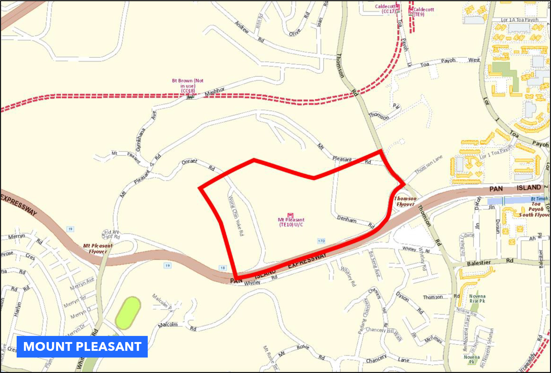
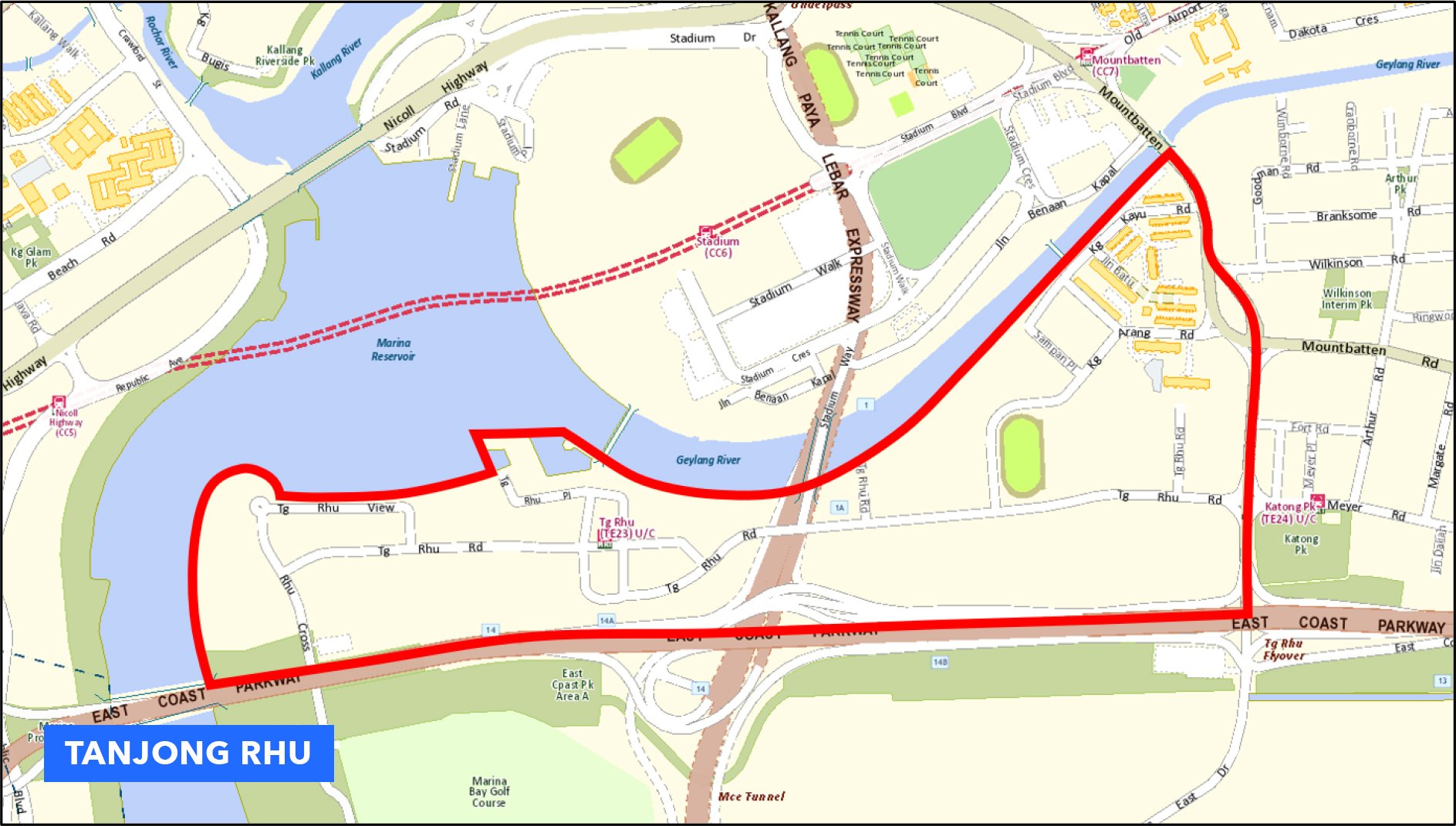
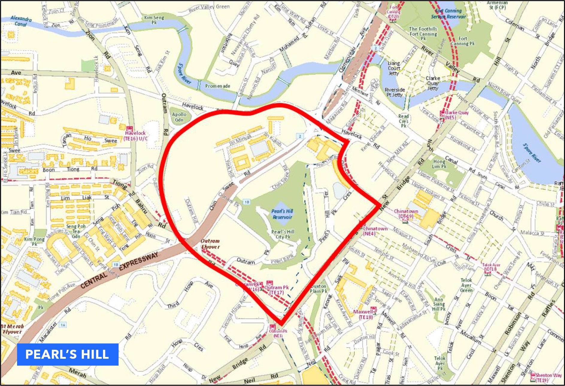
This includes the four public housing estates of Ulu Pandan, Mount Pleasant, Tengah and Keppel Club, on top of the existing ten car-lite areas. The other two areas are Pearl’s Hill and Tanjong Rhu.
Five car-lite areas of Kampong Bugis, Marina South, Jurong Lake District, Bayshore and Woodlands North were gazetted in February 2019.
Jurong Innovation District, One-North, Punggol Digital District, Springleaf and Woodlands Central were gazetted in August 2020.
What do car-lite areas mean?
HDB and LTA stated that car-lite areas are planned upfront, with good public transport as well as walking and cycling path networks. These car-free infrastructures allow for fewer parking lots in the designated areas and improved connectivity and convenience.
It also frees up space for public facilities and greenery. Residents of these precincts will be prioritised when it comes to parking through new parking demand management measures.
Ulu Pandan
Ulu Pandan will be the first HDB car-lite precinct, with the first BTO flats slated to launch in the November 2022 HDB BTO sales exercise. To encourage residents to ditch their vehicles and go green, HDB will reduce the number of car parking spaces around Dover MRT.
Shared community spaces, pedestrian and cycling paths and parks will take the place of these areas, with the Park Connector Network providing residents convenient access to the neighbourhood centre and key amenities in the vicinity.
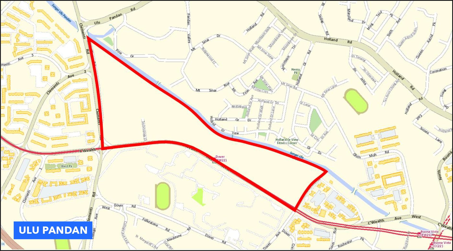
Residents can look forward to convenient access to rail and bus services, with sheltered elevated linkways connecting directly to Dover MRT and barrier-free accessibility to bus stops along Commonwealth Avenue.
Some other measures to promote a less carbon-intensive mode of commuting include:
- Reduced season parking, which will be restricted to residents only. It’ll also be prioritised for the first car of resident households.
- Residents with more than one car will be charged a higher Tier 2 season parking rate (S$190 a month), which is subject to availability.
- Short-term parking will still be available to visitors, but lots are limited. Parking charges may also be adjusted based on demand.
- Non-residents cannot buy season parking within the car-lite precinct.
Range-based Parking Provision Standards (RPPS)
LTA introduced the Range-based Parking Provision Standards (RPPS) that included a new parking Zone 4 for car-lite areas in November 2018, which came into effect in February 2019.
What is Zone 4? Areas classified as Zone 4 are car-lite areas planned for strong public transport connectivity and walking and cycling options. This means fewer parking lots, with parking applications by developments vetted by LTA on a case-by-case basis depending on the planning intent for the area, accessibility to public transport, as well as walking and cycling infrastructure.
Boundaries of the new car-lite areas classified as Zone 4 are in the Central, West and East areas of Singapore:
Central (including Ulu Pandan)
Mount Pleasant
Tanjong Rhu
Pearl’s Hill
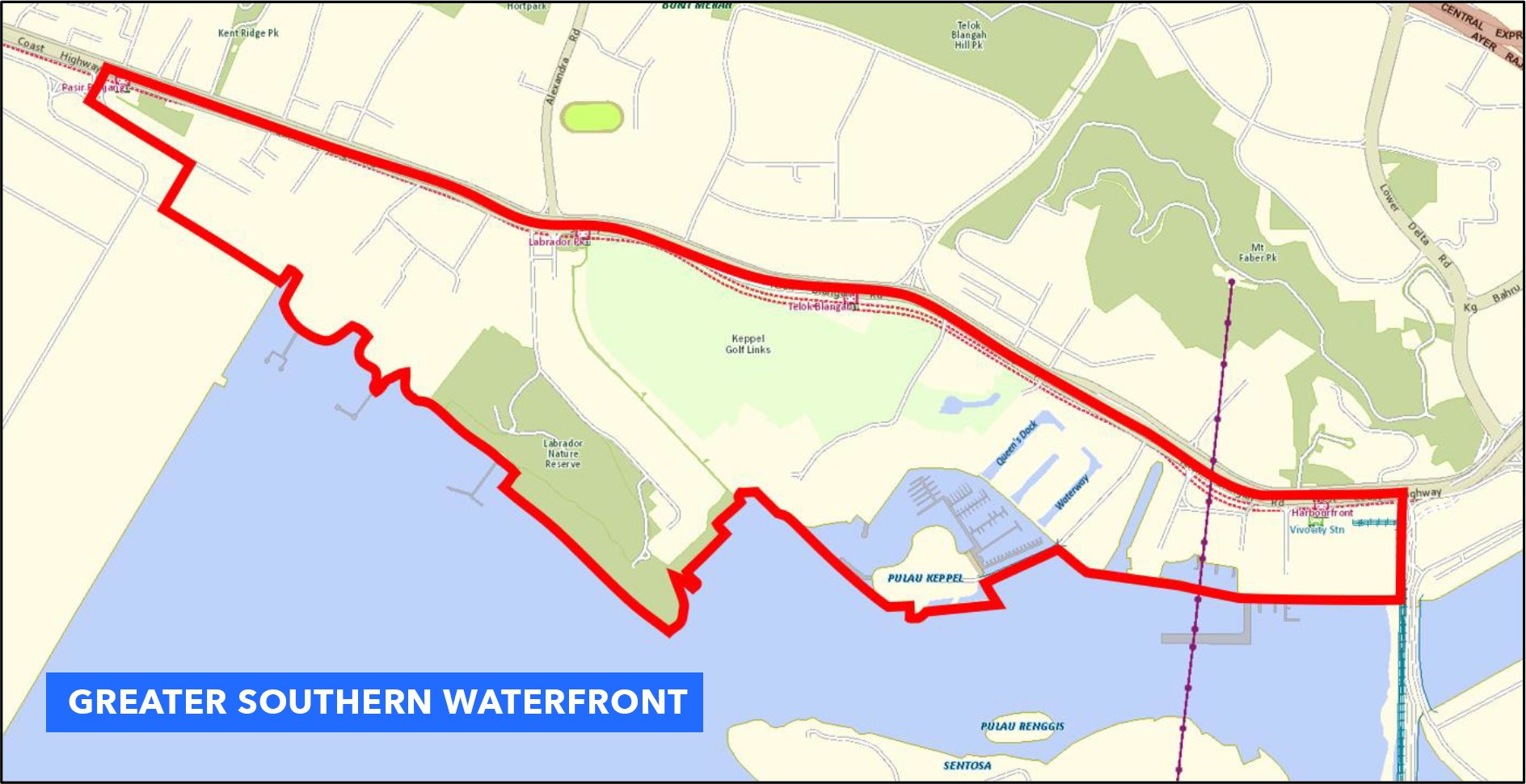
Greater Southern Waterfront
West
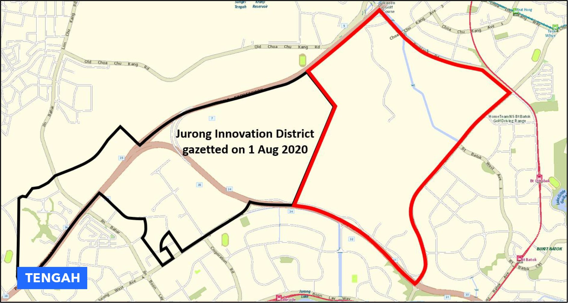
Tengah
East
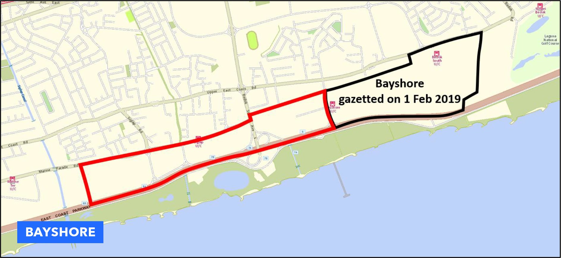
Bayshore
What other car-lite initiatives are there?
By going car-lite, the community and city enjoy many benefits by having vibrant, meaningful public spaces. There are three main initiatives where designated areas are closed off to all metal machines so that people can use the space instead.
1. Car-Free Sundays
Started in 2015 as a community initiative by the Urban Redevelopment Authority (URA), Land Transport Authority (LTA), National Parks Board (NParks), National Arts Council (NAC), Health Promotion Board (HPB), Sport Singapore (SportSG) and Singapore Land Authority (SLA), Car-Free Sundays closes selected public roads over the weekends to host activities for the public and enliven the streets.
There have been heritage-themed and family-friendly activities, such as “Our Telok Ayer Stories”. Telok Ayer Street and Amoy Street were closed to promote the heritage of the conservation area, with pop-up exhibitions such as the street photography workshops and the Telok Ayer Walking Tour that takes visitors on a journey to learn about the different architectural styles and the people who resided in the area.
The pandemic has put a pause on festivities, so here’s hoping that Car-Free Sundays will be back soon.
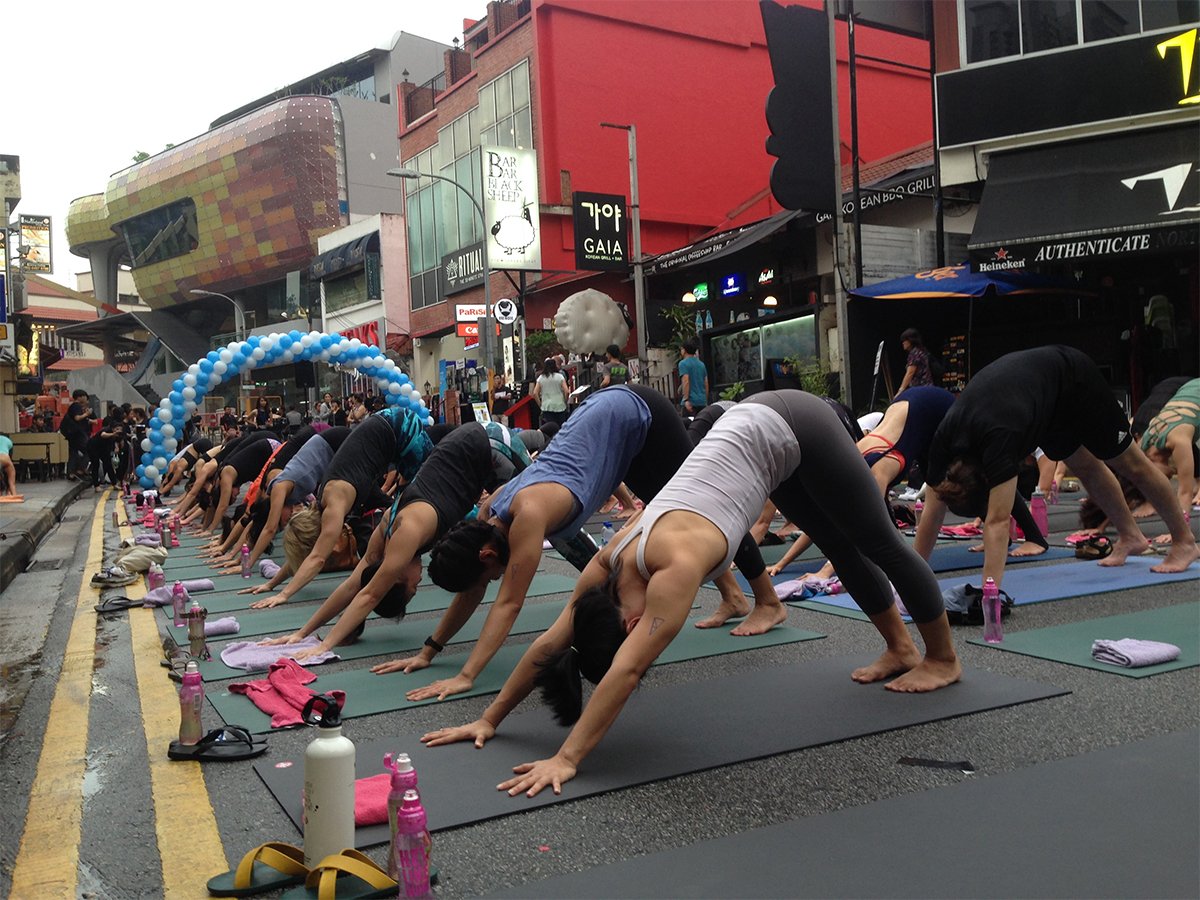
2. Car-Free Zones
URA has designated regular road closures on specific days to make space for public use. These roads include:
- Bali Lane and Haji Lane
Mon to Fri – 3pm to 1am
Sat, Sun, Eve of Public Holiday and Public Holiday – 12noon to 1am
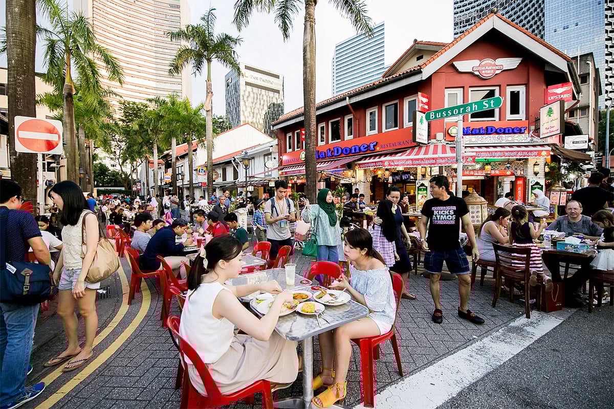
- Baghdad Street and Bussorah Street
Fri – 3pm to 1am
Sat, Sun, Eve of Public Holiday and Public Holiday – 12noon to 1am
With the closure of these roads, traffic congestion in the area is reduced, as well as on-street parking lots. Activities such as walking open markets and public performances can take place instead.
3. Transforming Streets
To bolster vibrancy and footfall in Singapore’s public spaces, the Lively Places Programme is a joint initiative by URA and HDB, along with community-led efforts to provide more community spaces by closing streets usually reserved for cars.
Spread across Singapore, various estates enjoyed the road closures in shared spaces, with residents participating in activities such as exhibitions, hands-on handicraft workshops, and even picking up new skills like gardening and creating digital ads.
If you would like to empower and contribute to your community by starting and participating in such projects, the Lively Places Fund provides up to S$20,000 from HDB.
Cycling Path Network
Other car-lite initiatives include tripling Singapore’s islandwide Cycling Path Network (CPN) from its current 460km to more than 1,300km by 2030. Currently, there are CPNs in nine HDB towns, with new infrastructure being developed in six more towns.
The CPNs provide a safe and conducive environment for commuters to cycle from their homes to MRT stations, bus interchanges and nearby amenities like malls and schools.
You can find the complete map of Singapore’s CPN here.
What do you think of going car-lite? Let us know in the comments section below.
If you enjoyed this article, check out On the right track with the Cross Island Line and HDB town Tengah to be car-free, set in greenery.
The post Car-lite areas: What do they mean for Singapore? appeared first on .
