One of the worst things that can happen to landed and ground floor homeowners in Singapore’s housing estates is to fall victim to a flash flood. The thing is, despite having a well-planned drainage system, floods in Singapore are still actually relatively common during the rainy season, and some housing estates are more flood prone than others.
The PUB puts out a occasionally updated list of flood prone areas, and describes these areas as “low-lying, with a history of flooding”. The list, along with an additional list of “hotspots”, can be found at the bottom of this page.
Why are there flood prone areas in Singapore?
We won’t get too sciency, but basically 30% of the Singapore’s land is 5 metres above sea level or lower, and most of the island is no more than 15 metres above sea level. When high tides coincide with heavy rainfall, the amount of water can overwhelm the capacity of a location’s drainage system, which results in a flash flood.
Quite a few housing estates in Singapore are low-lying, with limited drainage and runoff capacity, and hence have a greater tendency to become flooded. That being said, PUB is actively lowering the number of flood prone areas in Singapore by improving and expanding drainage, and implementing measures such as covering open drains with mesh to prevent fallen leaves from causing obstruction.
In any case, flash floods in Singapore are relatively minor. Water levels typically reach less than 30cm in height and floods tend to subside in about half an hour.
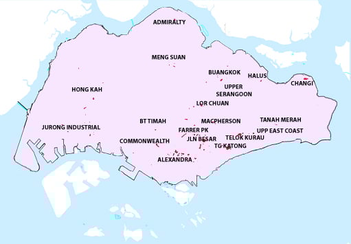
Based on PUB’s latest data (May 2020), we’ve identified the most flood prone housing estates in Singapore (in no particular order), they are:
Flood prone housing estate #1: Commonwealth
Where exactly (according to PUB): Commonwealth Ave / Commonwealth Drive / Queensway / Margaret Drive
Why it’s flood prone: The area around Commonwealth is basically a giant basin, as it is surrounded by higher ground of Holland and Buona Vista. Water is unable to drain directly towards the sea because of the Southern Ridges, and the area is not served by a canal. There are a few ground floor HDB flats and shop units in this area whose owners should take precautions to minimise property damage during flash floods.
Flood prone housing estate #2: Farrer Park
Where exactly: Farrer Park Area (including Thomson Road / Derbyshire Road) / Farrer Park Field
Why it’s flood prone: This is a low-lying area and the Rochor River is relatively shallow, but the situation has greatly improved through the years. Just ask the older generation who used to “swim” in Farrer Park Field after heavy rain!
Flood prone housing estate #3: Tanjong Katong
Where exactly: Meyer Road / Fort Road / Arthur Road / Margate Road / Ramsgate Road / Jalan Seaview / Tanjong Katong Road South
Why it’s flood prone: Not only is East Coast neighbourhood near the sea, Meyer Road used to be right by the seafront prior to reclamation in the early 1970s. Because this was already a populated landed estate at the time, there was little that could be done to elevate the area or add more drainage, so the area has been on PUB’s flood prone list for decades. It was most recently hit by flash floods in December 2020, and it’s not known if the future underground Tanjong Katong MRT station will improve the situation or make it more challenging for residents.
Flood prone housing estate #4: Sennett
Where exactly: Sennett Estate (Puay Hee Avenue, Siang Kuang Ave, Wan Tho Ave, Jalan Kemboja, Mulberry Ave and Jalan Wangi)
Why it’s flood prone: Historically, the area around low-lying Sennett estate in Macpherson is swampland. This neighbourhood is near Paya Lebar, which literally means “wide swamp” in Malay. While the swamp has been filled in, Sennett is continuously inhabitated since those days and improvements to drainage is hence limited.
Like Tanjong Katong, Sennett’s status quo meant that it’s been a flood prone area for ages. The construction of a water retention pond in the neighbouring Bidadari estate could help reduce the flood risk, but residents in the predominantly landed Sennett estate have wisened up over the years and are careful to pick furniture that’s elevated above ground.
Flood prone housing estate #5: Stevens/Balmoral
Where exactly: Stevens Road/ Balmoral Road
Why it’s flood prone: Mostly consisting of condos and landed properties, this is a housing estate dotted with small hills. You won’t notice them because they’re built over, but when it rains heavily the combined runoff to lower-lying areas of the estate could cause flash floods. Flash floods in the area damaged the wall of a landed property in 2017.
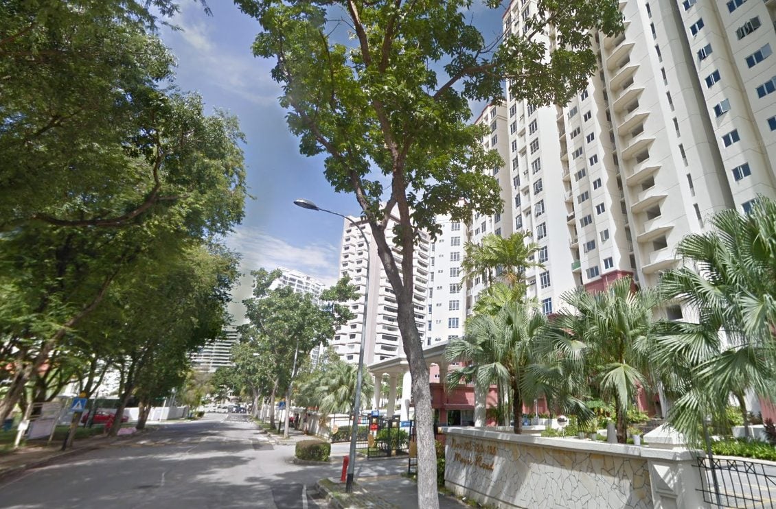
Flood prone housing estate #6: River Valley/Alexandra
Where exactly: Delta Road/ River Valley Road / Delta Avenue / Alexandra Road / Jervois Road/ Bishopsgate Road
Why it’s flood prone: Located in the upper reaches of the Singapore River and where the Alexandra Canal begins, the area is a densely packed low-lying private residential area that may face trouble channeling rainwater to the waterways during heavy rain. Jervois Road, in particular, is barely above high-tide level, according to the Ministry of Environment and Water Resources (MEWR) in a 2009 press release.
Madam Sim Geok Hwee, a Jervois Road resident, said in a 2017 PUB media release that “the flood protection for my area has improved” since PUB carried out a drainage improvement project at Jervois Road in 2010. Residents continue to receive regular flood advisories distributed door-to-door by the PUB officers, with contact numbers for them to provide drainage-related feedback or request assistance.
Here’s a rundown of all flood prone areas in Singapore, according to PUB, as at May 2020:
1. Hong Kah area
2. Second Chin Bee Road
3. Commonwealth Ave / Commonwealth Drive / Queensway
4. Jalan Mat Jambol
5. Neo Pee Teck Lane/ Pasir Panjang Road
6. Admiralty Road West near Sembawang shipyard
7. Jalan Taman
8. Stevens Road/ Balmoral Road
9. Farrer Park Area (including Thomson Road / Derbyshire Road) / Farrer
Park Field
10. Waterloo St / Albert St / Bencoolen St / Prinsep St
11. Jalan Besar Area
12. King George’s Avenue (People’s Association HQ)
13. CTE near Slip Road to Moulmein Road
14. Jalan Mashor
15. Delta Road/ River Valley Road/ Delta Avenue
16. Alexandra Road / Jervois Road/ Bishopsgate Road
17. Lower Delta Road / Alexandra Road
18. Beach Road
19. Margaret Drive/ Tanglin Road
20. South Bridge Rd/ North Canal Rd/ Upp Hokien St/ Upp Pickering St
21. Indus Road
22. Zion Rd (Boys’ Brigade HQ)
23. Langsat Road Area
24. Rose Lane
25. Sennett Estate (Puay Hee Avenue, Siang Kuang Ave, Wan Tho Ave,
Jalan Kemboja, Mulberry Ave and Jalan Wangi)
26. Meyer Road / Fort Road / Arthur Road / Margate Road / Ramsgate Road
27. Jalan Seaview/ Tanjong Katong Road South
28. Jalan Gembira
29. Jalan Benaan Kapal
30. Service road off Tampines Road (near Jalan Teliti)
31. Lorong Buangkok
32. Mimosa Walk
33. Mindef’s Changi Camp off Farnborough Road
34. Bedok South Rd/ Bedok South Ave 1
35. Chin Cheng Ave
36. Lorong H Telok Kurau near Siglap Canal
37. Upp East Coast Road (junction with Parbury Avenue)
38. New Upper Changi Road (Chye Heng Garden)
And here’s the list of PUB hotspots specifically for the December 2020 to March 2021 monsoon season:
1. Jalan Boon Lay (near International Road)
2. Enterprise Road
3. Chin Bee Ave (near Third Chin Bee Road)
4. Jurong East Street 32
5. Mandai Road/ Woodlands Road junction
6. Woodlands Road /Mandai Estate Junction
7. Lorong Kismis
8. Bukit Timah Road between Wilby Road to Blackmore Drive
9. Dunearn Road (between Yarwood Ave and Binjai Park)
10. Yishun Ave 2/Yishun Ave 5 (Slip Road)
11. Upper Thomson Road/ Jalan Keli
12. Ang Mo Kio Ave 3/ Ang Mo Kio Ave 8 Junction
13. Yio Chu Kang Rd (near Wembley Residences)
14. Lorong 1/ Lorong 2 Toa Payoh junction
15. Upper Thomson Road /Jalan Lembah Thomson Junction
16. Eng Neo Avenue (near Vanda Link)
17. Dunearn Road (near Watten Estate Road)
18. Shenton Way/ Boon Tat Street/ Boon Tat Link
19. Craig Rd / Tg Pagar Rd junction
20. Cavenagh Road/ Kramat Lane
21. Kampong Ampat
22. Upper Paya Lebar Road
23. Arumugam Road
24. Paya Lebar Road
25. Marine Parade Central
26. Jalan Tari Zapin (near Jalan Kayu)
27. Hougang Ave 8
28. Seletar North Link
29. Jalan Nipah
30. Bedok North Avenue 4 and Upper Changi Road (Junction)
31. Upper Changi Road East
The areas in bold indicate newly-added locations by PUB. The “hotspot” list was last updated in October 2020.
How does PUB detect floods in Singapore?
PUB has a network of over 200 Water Level Sensors and CCTVs to monitor and detect rising water levels that could lead to floods. This official webpage has an interactive map showing the real time water levels at the sensors. The public can also subscribe to SMS alerts via the webpage, for timely updates on potential flash floods.
The public can also receive alerts by following PUB on twitter: @PUBSingapore
What should I do during a flash flood?
Don’t panic, check out this video by PUB:
Do you live in a flood prone housing estate? Consider signing up for a comprehensive home insurance.
If you found this article useful, 99.co recommends Property Jargon of the Day: Home Content Insurance and 7 simple energy-saving tips to reduce your monthly utilities bill
Looking for a property? Find your dream home on Singapore’s most intelligent property portal 99.co!
The post The most flood prone housing estates in Singapore, according to PUB appeared first on 99.co.
